
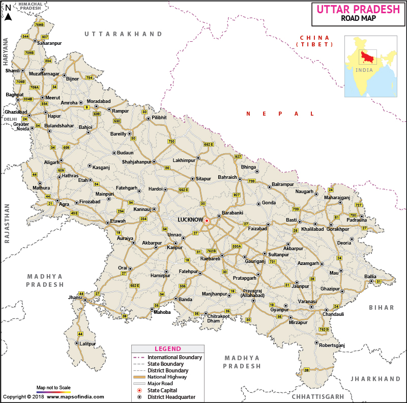
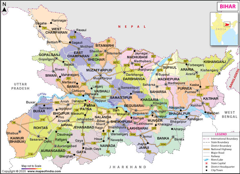
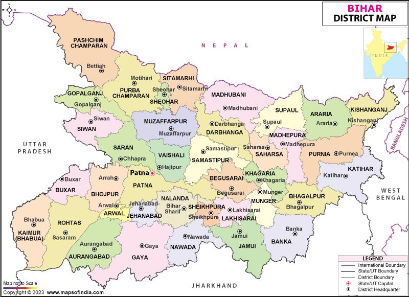
Arrah is a city and a municipal corporation in Bhojpur district in the state of Bihar, India. The name is also sometimes transliterated as Ara. It is the district headquarters of Bhojpur district, located near the confluence of the Ganges and Sone rivers, some 24 miles from Danapur and 36 miles from Patna.[1


History[edit]
Arrah is an ancient city with references in mythological stories and Greek geographical works. It has been a centre of attraction forJainism with dozens of old temples and hermitages.[citation needed] It is known for the important battle (Battle of Buxar) in October, 1764, when Mir Kasim, Nawab of Bengal with the support of the Mughal Emperor Shah Alam II and Shuja-ud-daulla, Nawab of Avadh was defeated by the East India Company Army whilst Henry Vansittart, was Governor General, the key event establishing the British colonialisation of India.[citation needed]
During the Indian rebellion of 1857, a small party of British officers and Indian soldiers was besieged in the Little House at Arrah, by a band of armed soldiers under the command of 80-year-old Veer Kunwar Singh, the Zamindar of adjacent Jagdishpur. They withstood the siege for three weeks until relieved by other East India Company troops.[2] Babu Kunwar Singh was the only successful freedom fighter of the rebellion of 1857. The British failed to defeat him. Veer Kunwar Singh (1777–1858), one of the leaders of the Indian Rebellion of 1857, belonged to a royal Kshatriya (Rajput) house of Jagdispur, currently a part of Bhojpur district, Bihar state, India. At the age of 80 years, during India’s First War of Independence (1857), he actively led a select band of armed soldiers against troops under the command of the East India Company, and also recorded victories in many battles.
Bhojpur District |
| Bhojpur is an administrative district in the state of Bihar in India. The district headquarters are located at Arrah also known as Ara.The district occupies an area of 2,474 km² and has a population of 1,792,771 (as of 2001). History This district played a major role in India's struggle for independence. Veer Kunwar Singh of Jagdishpur was the leader of the mutineers during the first war of independence in 1857, called the Sepoy Mutiny by the British. The fighting was so severe that two of the five Victoria Crosses ever awarded to civilians by the British were awarded during this battle. A third VC was awarded to an army officer. Prior to 1972 the district of Rohtas was part of Bhojpur.In 1972 it (Rohtas) became a second district. Sub Divisions: Ara Sadar, Jagdishpur, Piro Blocks: Ara Sadar,Udwantnagar, Jagdishpur, Koilwar, Sahar, Barhara, Sandesh, Shahpur, Charpokhari, Piro, Tarari, Bihia, Agiawon, Garhani Agriculture: Rich Paddy Fields, Wheat, Maize, Bengal Gram, Grain Industry: Rice and Oil Mills. Rivers: Ganges, Sone. Hotel:Shivam rest House,Park View Hotel. Colleges:Maharaja College,Jagjivan College,Jain College, Brahamrishi College School:H.N.K High school,H.P.D Jain school. Historical Places Krishan Garh, beside the river Ganga in the Ara District, is the location of a five hundred year old temple dedicated to |
No comments:
Post a Comment